Application of Handheld Laser Range Finder in Archaeological Research
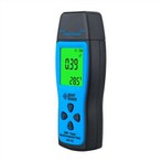
At present, tape measure, steel tape, GPS, total station and other instruments are widely used in field archaeology to measure length, area, volume, etc., and total station, GPS-RTK, etc. are used for topographic surveying, square layout, and project stakeout. So, what can a handheld laser rangefinder do? The handheld laser rangefinder can also realize the functions of measuring distance, area, volume, and setting out with theodolite.
Distance measurement, the most used function in archeology. Two examples are used below to illustrate: 1. In the process of drawing the plan and profile of the tomb, the length, width and height of the tomb should be measured and registered, and then drawn according to the scale. It is assumed that the tomb is a vertical pit tomb with the same size as the bottom of the mouth. If you want to measure the width of the tomb, set the hand-held laser rangefinder (Hilti PD42) to start counting from the bottom of the instrument, then stick the bottom of the hand-held laser rangefinder to the tomb wall, keep the horizontal key, and then the tomb width data will be displayed. will be displayed on the screen. The length measurement is similar to the width. The depth measurement can be measured directly from the tomb entrance downward, and a target board is also placed at the tomb entrance, and then measured from the bottom of the tomb upward, and the effect is the same. If the bottom of the tomb mouth is different, in order to prevent the influence of the inclined tomb wall, an extension rod can be used for time-lapse measurement. 2. Measurement of the sealing mound. Set the handheld laser rangefinder to the triangulation mode, then use the handheld laser rangefinder as the apex (level with the bottom of the mound), and measure the distances to the bottom and top of the mound respectively, then the height of the mound will be displayed in the instrument automatically calculated and displayed. This function is especially practical in the wild. In the survey of the resources of the Great Wall, some beacon towers cannot be climbed or are difficult to access. This function can be used to measure the height of the beacon towers; etc. are also inaccessible and can also be measured using this function.
Area and volume measurements are also widely used in archaeology. For example, the area of the exploration square, the area of the opening of the tomb, the area of the city site, the earthwork of the exploration square, the earthwork of the tomb, etc. To realize these functions, you only need to switch the function option of the handheld laser rangefinder to the corresponding option, and then measure two to three data of the entity to obtain the area and volume data. As for the stakeout function of the handheld laser rangefinder, I won’t go into details here, because the stakeout function of the total station and GPS-RTK is much more powerful than it.
Summary and Recommendations
The hand-held laser rangefinder is fast, accurate, easy to operate, and easy to carry. These advantages are worthy of our promotion in archaeological work. However, it also has disadvantages, such as: short measurement range, generally around 200 meters, which cannot meet the needs of large-scale measurement; high price, generally ranging from several hundred to several thousand yuan. Therefore, in archaeology, we should use hand-held laser rangefinders in conjunction with other surveying and mapping instruments to give full play to the advantages of various instruments and improve the accuracy and efficiency of archaeological surveying and mapping. (end)