Application of Laser Range Finder in Forestry
Data collection is used for forest resource inventory, that is, tree height, height that can be used as commercial timber, vegetation mapping, wild special tree species, excellent tree species location, determination of tree grade and economic value in the area, or in cultivation management research. Branches, determining tree locations where specific heights are produced, profiling felled volumes, and determining resource boundaries; used for topography, mapping, and for general purposes of baling lumber access when harvesting lumber considering baling lumber methods Pre-construction surveys of roads and rough trails are important. Various problems (eg, cost, accuracy, obstructions, etc.) may be encountered using conventional surveys, aerial photography, and GPS positioning that have been available in the past.
Field data collection is a problem that has long plagued surveyors, cartographers, GIS database managers, engineers and researchers. The problem is simple: how to efficiently and accurately collect location and physical characterization data for mapping, cataloging, inventory, and storage in databases.
Finding out the outcome of this problem in a given situation is annoying. because:
(1) There may be many methods and techniques that can be used;
(2) In the vast majority of cases, no method alone can provide complete and satisfactory results.
The application of laser technology, especially the laser range finder developed by the American Laser Technology Corporation (LTI), has been perfected since 1990 by the US Department of Agriculture Forestry Bureau as a field measurement prototype and evaluated its future development and application, and can be combined with data acquisition. GPS connection, and can be configured with a variety of software, so that forestry surveying advances from hand-operated compass, rope, inclinometer and old-fashioned telescope to the era of single-person operation, all-station, comprehensive multi-purpose instrument.
The measurement system designed by LTI is suitable for basic vegetation resources and timber sales inspection and planning measurement, logging volume distribution map and road survey measurement. By June 1993, the US Forest Service had purchased more than 150 of these instruments. In field planning use by the USDA Forest Service, the laser range finder is not only functional, accurate and durable, but also cost-effective, especially where the target is unclear. This is evident from the scrublands of northern Idaho to the great rain forests of southeastern Alaska.
China, with its vast resources, is rich in forestry resources. With the large-scale production brought about by the reform and opening up, the important position of forestry in the national economy has become increasingly prominent, and the demand for commercial timber has surged. How to plan the development of forestry, measure forestry resources with higher precision, and check and catalog safer forestry resources focusing on timber sales have become important issues for the forestry department. Our introduction of laser measurement technology will help promote my country's forestry measurement technology into a new era.
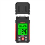
Uses of multifunctional laser measuring systems
(1) Distance measurement----distance measurement is the main function of this instrument, which can directly display horizontal distance or inclined distance.
(2) Azimuth ---- It can directly display the magnetic azimuth or relative azimuth of the measurement target.
(3) Inclination angle----can display the inclination angle (vertical angle) or the inclination percentage.
(4) Target coordinate program - the target program function is the so-called addressing or stake-fixing (stake-out) function in measurement, that is, input its coordinates (X, Y, Z) into the instrument at a known point, and align it with the measurement target Measurement can immediately display the coordinates of the measured position.
(5) Height measurement - use the triangulation principle (pitch, elevation angle and horizontal distance) to measure the height of objects, including tree heights, building heights, etc.
(6) Measuring function----This instrument has another special function program, which can directly enter the measuring function, carry out measuring work and automatically store azimuth, distance, inclination angle and other data, and can be input into the computer for calculation by PC software deal with.
(7) Navigation function--Because it has a magnetic flux compass, it can serve as a navigation function.
Discussion on Application of Multifunctional Laser Measuring System in Forestry
(1) Forest Land Measurement
Since the multifunctional laser measurement system combines laser distance measurement and electromagnetic digital compass, its distance measurement and angle measurement accuracy are much higher than those of compass and rope measurement. It is the best new instrument for forest land measurement.
According to the test, the advantages of the multifunctional laser measuring instrument applied to forest land measurement are:
1) The operation is simple, the measurement is locked very quickly and the precision is high. The instrument can automatically record data, computer transmission, no human error.
2) The digital instrument panel is automatically displayed, and there is no human error in visual interpretation.
3) Save manpower and time.
4) Attached with processing software, it can handle points, lines, wires and calculate closure difference, area, etc., and can be connected to a printer or plotter to directly draw measurement graphics.
(2) Combination of multifunctional laser measuring instrument and GPS
The introduction of multifunctional laser measuring instruments was mainly combined with GPS, that is, GPS cooperates with multifunctional laser measuring instruments for measurement in areas with restricted terrain.
application:
1) Banning and checking of illegal land reclamation
Combining laser measuring instruments with GPS, GIS and their software, and carrying out environmental monitoring with portable computers is currently the most popular research project in various academic institutions. In forestry, it is used for the banning and checking of illegal land reclamation. However, because GPS may be restricted by terrain, further research and testing are needed. In addition, it can also be combined with a digital camera to take pictures of violations and archive them for evidence of banning.
2) Land lease inspection
The combination of multi-functional laser measuring instrument and GPS to carry out land lease inventory work is not only fast, but also has a high degree of safety. In addition, the digital map files can also be pre-entered into a portable computer and carried to the site for inventory and comparison work.
3) Inventory of security forests outside the area
At present, the inspection of security forests outside the bureau area uses electronic flat panel for inspection and pile placement. However, due to the lack of triangular points, the inventory work is often slow. If the centimeter-level GPS can be used to arrange points, and then the laser measuring instrument is used for surveying, and the target coordinate program function is used for pile placement, it should be able to speed up the inventory work and reduce the post-event map data work.